April 2023 - 17 Dwellings at Almsford Bank plans submitted for FOURTH time!
If you have previously commented on this application, please reaffirm your objections to this development by commenting again. This site has already been turned down and applications withdrawn or refused on multiple occasions - but the developers are persistent and will get their way if not stopped. Because this is a new application all previous comments are disregarded.
It is vitally important to stress that this development will cause demonstrable harm and desecration of the Special Landscape Area.
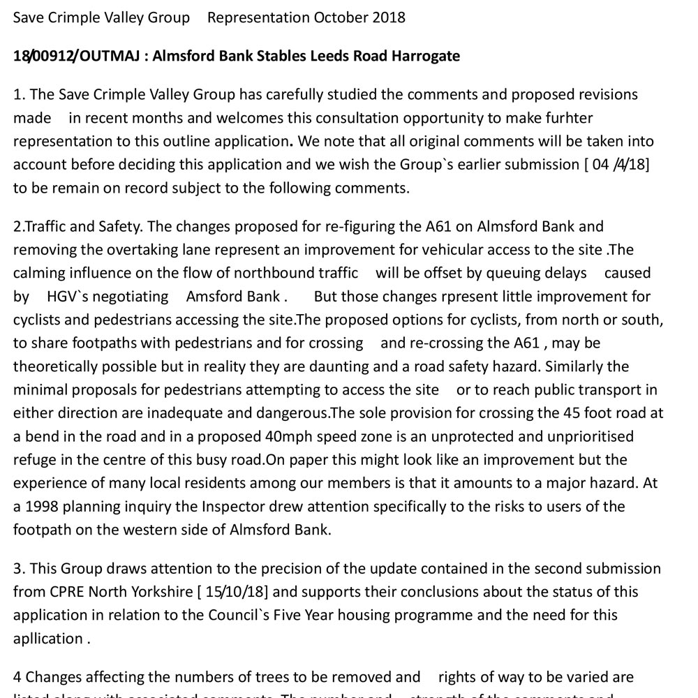
We have compiled a list of key documents below which we suggest objectors look through and use to base their own comments on. Full details of how to object are also provided below.
Comment before the 7th May 2023* to help save the Special Landscape Area.
* Deadline seems to have been extended from 23rd April 2023.
How can you help?
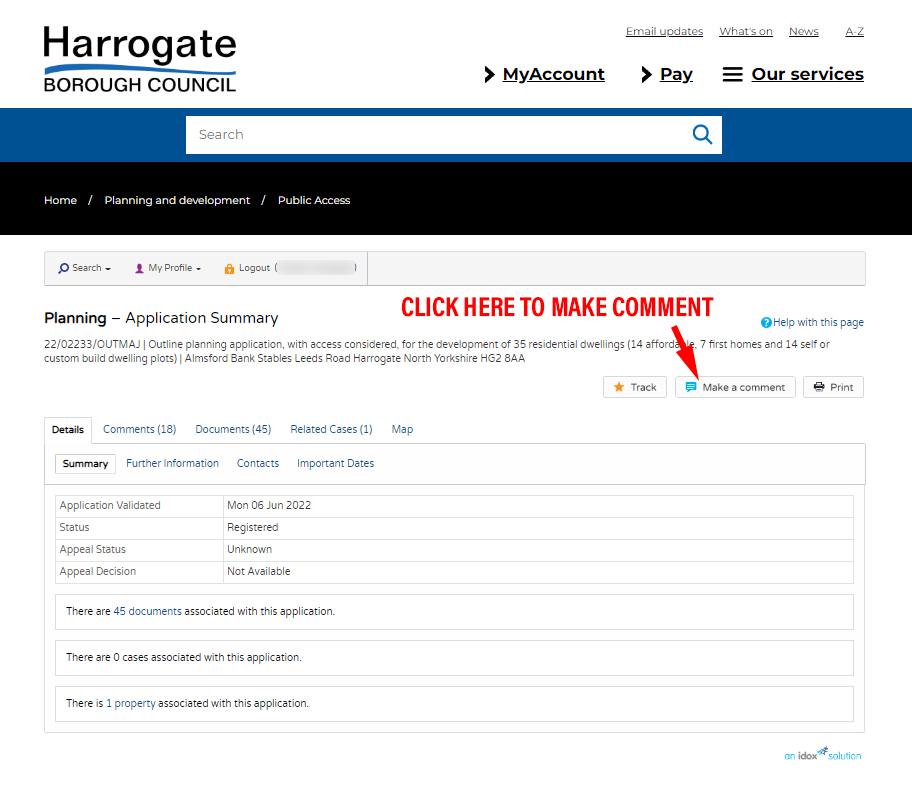
Comment by email, post or the Planning Portal - the deadline for objections is 7th May 2023
Build a Strong Argument in response
Landscape Character and Setting
The development is outside current and proposed development limits. Under 2001 plan should recognise:
- Local distinctiveness
- This is a designated Special Landscape Area (SLA)
- The setting and approach to Harrogate
- Local beauty spot
- The need to avoid coalescence and ribbon development
Access
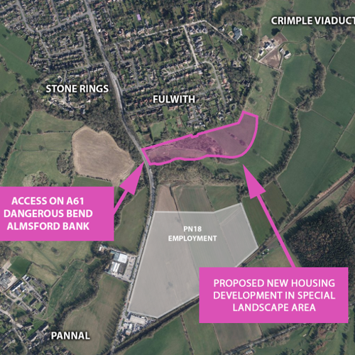
- Road safety: Traffic access - Almsford Bank is a serious known accident blackspot
- Public right of way
Coalescence
When considered alongside the emerging new Local Plan coalescence becomes inevitable. PN18 was approved in the Local Plan which could result in just a small strip of land separating Harrogate and Pannal.
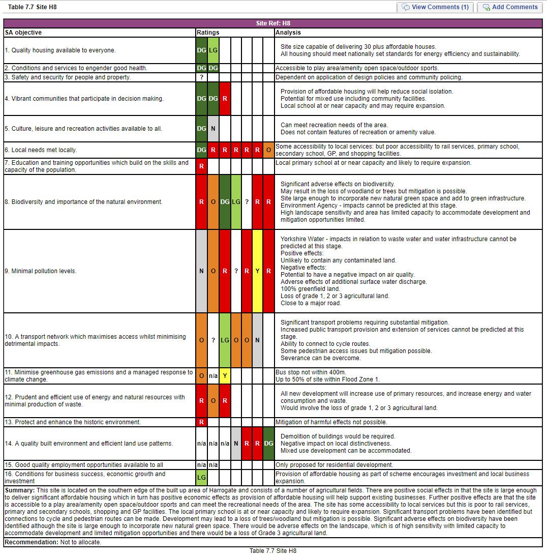
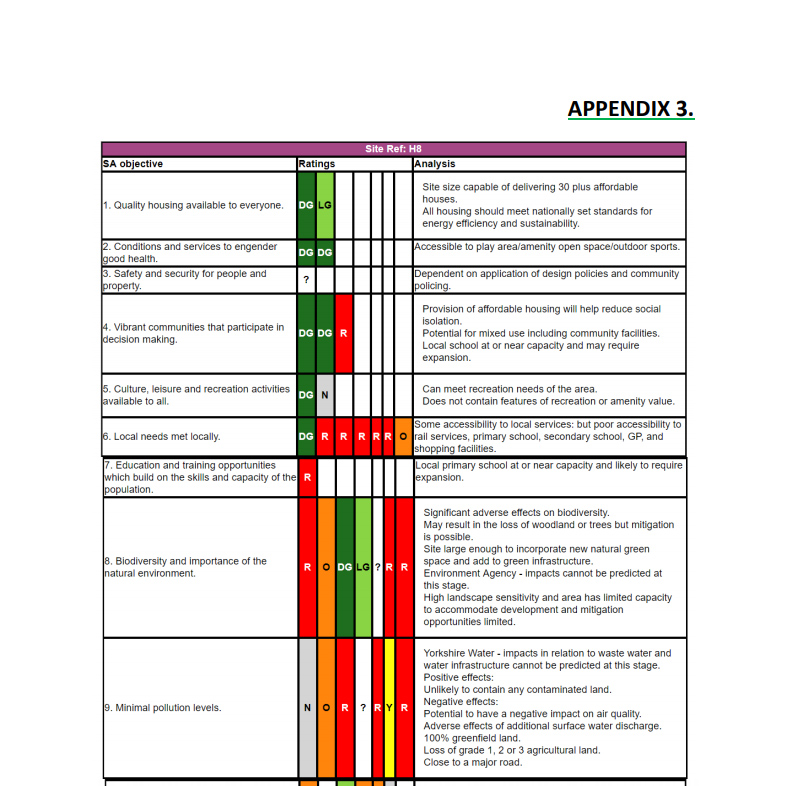
Harrogate District Draft Local Plan: Sustainability Appraisal 2016
Site Ref H8 is the plot of land in planning application 23/01082/OUTMAJ for 17 dwellings. This land was found unsuitable for development in the Councils own Sustainability Appraisal 2016. Full details below, click image for original source.
* Deadline seems to have been extended from 23rd April 2023.
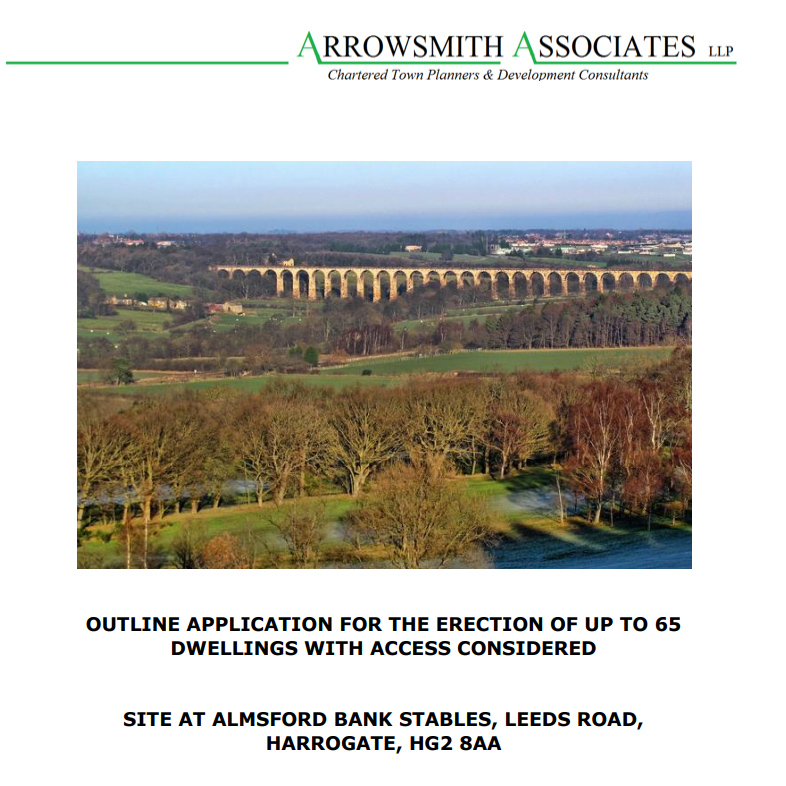
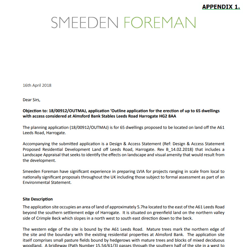
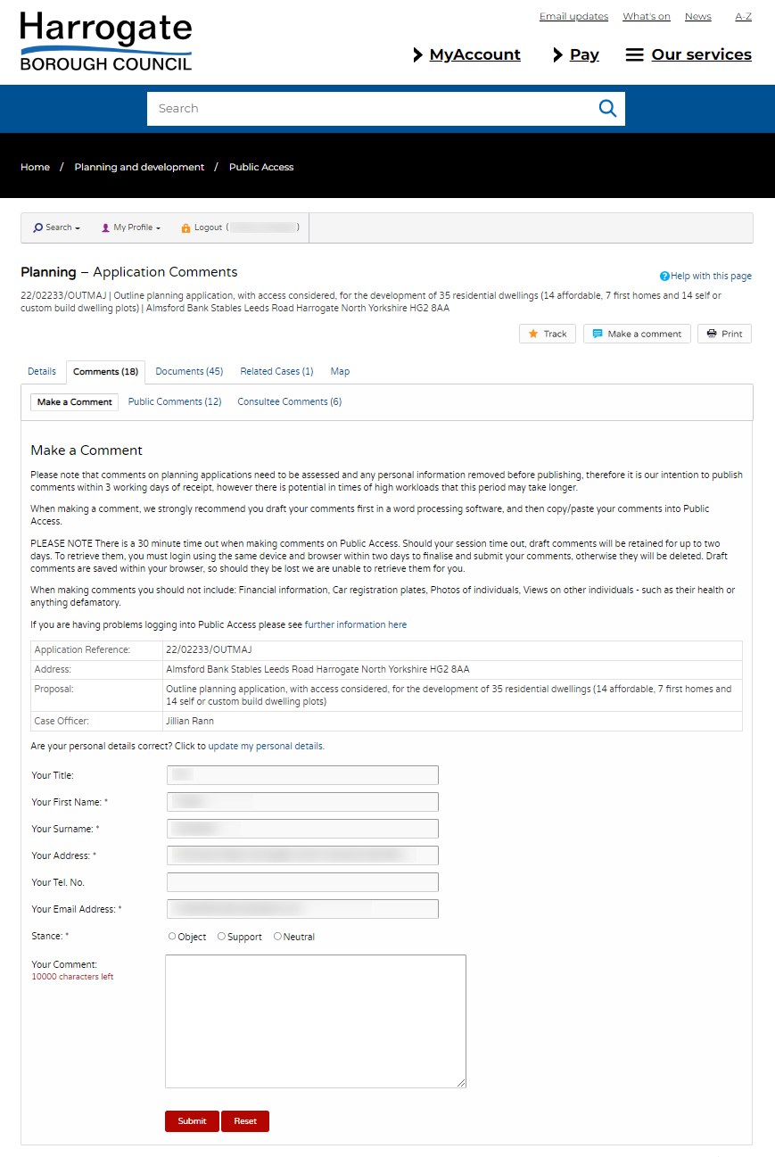
These are some suggestions and ideas to draw on when objecting to 23/01082/OUTMAJ | Outline application for the erection of up to 17 dwellings with access considered. Almsford Bank Stables Leeds Road Harrogate HG2 8AA. Please note your comments will be publicly visible for all to read once submitted to the Council Portal. All wording must be your own.
You can also submit comments via email or postal mail. If you do this you MUST provide your full postal address or your comments will be rejected.
The website for this planning application is different from the one used to comment on the Local Plan. Please follow the instructions below.
Every individual submission counts. Please help to get the word out by sharing this page, asking other people within your household, your local friends, family and neighbours to make their views known.
2022 PLANNING PERMISSION REFUSED
The reasons for the decision are as follows:
-
The application site is located outside the development limit for Harrogate and is not on land allocated for development in the Harrogate District Local Plan 2014-2035 (the Local Plan). Consequently, and as the Council is able to demonstrate a deliverable supply of housing land in excess of 5 years, the proposed development would undermine the Council's growth strategy as set out in the Local Plan, and is considered inappropriate in this location and contrary to Policies GS1, GS2 and GS3 of the Local Plan.
The proposed development would result in harm to the character and appearance of its surroundings, including the Crimple Valley Special Landscape Area, through the loss of open fields and woodland and the introduction of unacceptable and incongruous (sub)urban development into an area of high landscape value, important to the setting of Harrogate and the grade II* listed Crimple Valley Viaduct. The proposal would therefore fail to protect local distinctiveness or landscape character, and would be contrary to TOWN AND COUNTRY PLANNING ACT 1990 DCREOUTZ 22/02233/OUTMAJ Policies HP3, NE4 and NE5 of the Local Plan, to the guidance in the Harrogate District Landscape Character Assessment, and to the NPPF.
The proposed development would urbanise and erode the distinctive rural character of the Crimple Valley landscape, and would thus cause harm to the setting of the grade II* listed building, Crimple Valley Viaduct, and to the wider historic environment. The public benefits of the proposed development are not considered to outweigh the harm arising to the setting of the designated heritage asset, which would be less than substantial. The proposed development would therefore be contrary to Policies HP2 and NE4 of the Local Plan, to the guidance within the Harrogate District Landscape Character Assessment, and to the NPPF.
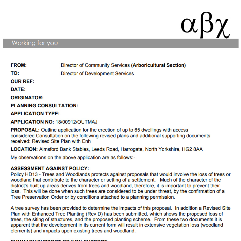
The removal of a relatively large number of mature trees, including trees protected by a tree preservation order, would result in the fragmentation of mature woodland and the loss of mature planting, to the significant detriment of the character and appearance of the site and the wider landscape. The proposals would also be likely to cause further tree loss, through potential disruptions to hydrology and/or nutrient pathways, and construction works unacceptably close to mature trees including ancient and/or veteran trees. Such losses would further harm landscape character. The submitted re-planting scheme underestimates likely tree loss as it does not take into account those likely indirect effects and it relies on works to transplant existing trees which are not considered practical or feasible. It would thus fail to compensate for the losses and harm arising from the proposed development. The benefits of the scheme do not outweigh the harm arising, nor do they represent wholly exceptional reasons for the likely deterioration of irreplaceable habitat including ancient and/or veteran trees. The development would therefore be contrary to Policies HP3, NE4 and NE7 of the Local Plan, to the guidance in the Harrogate District Landscape Character Assessment, and to the NPPF.
The introduction of residential development onto the site and the re-routing of the public right of way (a public bridleway) within the site, as indicated, would significantly change and erode the distinctive rural character of the existing public right of way. The proposed development would therefore fail to protect the recreational and amenity value of the public right of way. It would therefore be contrary to Policy HP5 of the Local Plan and to the NPPF.
On the basis of the information submitted, it has not been demonstrated that the proposed reduction in speed limit could be achieved in practice, or that the proposals would make safe and satisfactory provision for cycle infrastructure, with reference to relevant guidance. It has therefore not been demonstrated that the proposed development would provide a safe and suitable access to the site for all users, or that it would not have an unacceptable impact on highway safety. The proposed development would therefore be contrary to the NPPF.
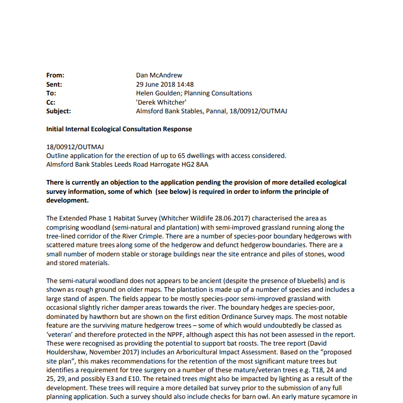
The proposed development would result in the removal of mature trees and would also involve development unacceptably close to trees considered to be ancient and/or veteran trees. As a result, the proposed development would have an unacceptable adverse effect on biodiversity and would result in the loss or deterioration of irreplaceable habitats including ancient and veteran trees. No wholly exceptional reasons exist with regard to any public benefit that would clearly outweigh the loss or deterioration of those irreplaceable DCREOUTZ 22/02233/OUTMAJ habitats. Therefore the proposed development is contrary to Policy NE3 of the Local Plan, to the guidance in the Providing Net Gain for Biodiversity SPD and to the NPPF.
On the basis of the submitted information, it has not been demonstrated that the proposed development would be satisfactorily drained, or that it would not result in flood risk elsewhere as a result of additional surface water runoff. The proposals would therefore conflict with Policy CC1 of the Local Plan and with the NPPF. 9 The application does not include an Energy Statement to demonstrate how the energy hierarchy set out in Local Plan Policy CC4 has been applied to make the fullest contribution to reducing greenhouse gas emissions. Consequently, it has not been demonstrated that the proposed development would be designed to reduce the extent and impacts of climate change or reduce carbon dioxide emissions as set out in the energy hierarchy, and the scheme therefore does not comply with Policy CC4 of the Local Plan. 10 No mechanism has been provided by which to secure necessary planning obligations via S106 legal agreement. Therefore the proposals would fail to mitigate the impacts of the development in terms of education and off-site public open space provision as well as secure on-site affordable housing, open space and biodiversity enhancements and their long-term management. Consequently, the proposal is contrary to the requirements of Policies TI4, HS2 and HP7 of the Local Plan and to the guidance in the Affordable Housing SPD and Provision of Open Space and Village Halls SPD.

